Hello Everyone,
I should start off by claiming I am still alive, but barely. This last year in grad school can slip by you very fast. Yeah, still going to try to submit this autumn. Run out of money you know? Project sort of completed, but with instrumentation, it can go on... and on...
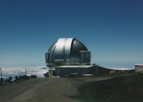
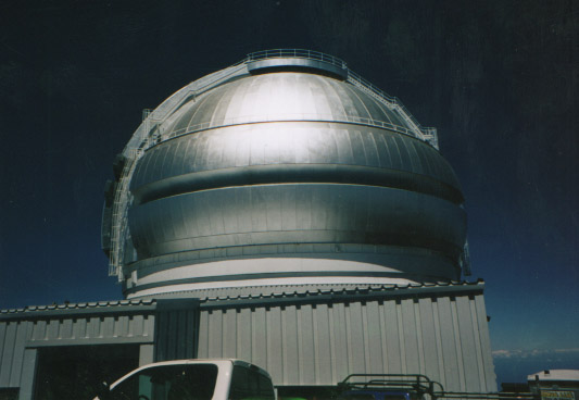
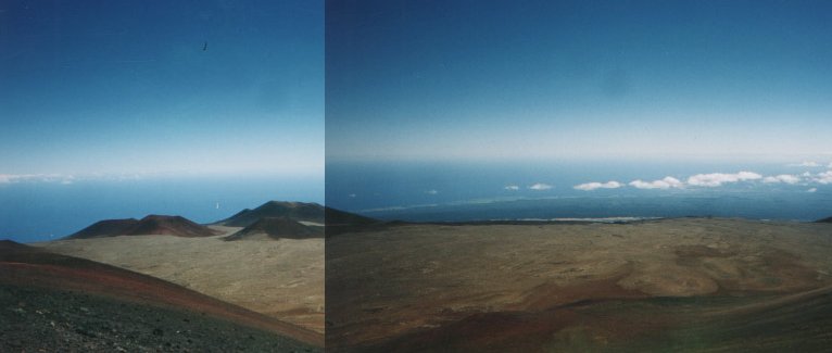
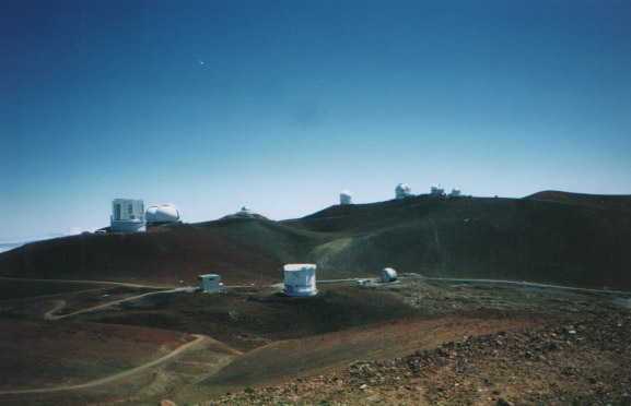
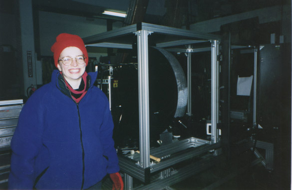
Well, my baby COHSI (Cambridge OH Suppression Instrument) had her maiden voyage across the Pond, continent, and Far Sea to the isle of Hawaii in March. The moment I had waited 3.5 years for was about to become a reality. We had nights 19 and 20 and 25-29th of March on UKIRT (United Kingdom Infrared Telescope) on Mauna Kea (Big Island of Hawaii). Broken schedule for two reasons: 1) If we had problems after two nights on the telescope, we would have four days to scratch and think ourselves through them (COHSI is a very complicated instrument which demonstrated a lot of NEW stuff) and 2) a conference (SPIE) on infrared instrumentation (held every four years so a *big* one for us) was scheduled during that gap. We negotiated our observing time to allow us to present a poster. Actually we had hoped for oral talks, but I think our poster did much better as a poster. So yeah, night schedule, day schedule, night schedule... Yipers!
I won't bore you with the details. Heck, if you are interested in the observing run and the current status of COHSI, just check out the links I am soon to create for it at:
I learned a great deal from the observing run. The downside is that I won't have any astronomical data for my thesis. That sure has me bummed out, even though I have been told I have more than enough for a thesis. I had been looking forward to sinking my teeth into some research. The run also added more work to my remaining time here in England. I am to help fix COHSI. I have some ideas and the dewar gets back on the pump this week. With luck, our guess that the throughput problem was due to the cold fiber feed (the only thing we could not fix at the telescope) will be correct. If so, we run a few more tests and apply for telescope time in the autumn. I am expected to submit in September so a second run will occur after my submission. The experiments over the next month will strengthen my thesis contents. But one can only hope!!!
So he did! Doug planned out a wonderful 8 day excursion back to southern Utah. Canyonlands country. I have very fond memories of my first adventures in the SW last March (1997) that I sure was looking forward to this trip!
This time we had Doug's car, the little Rav, a four wheel which would bring us to some amazing ruins and trailheads in our adventures.
We headed south through Wyoming to Utah to our first stop-the Dinosaur Quarry-Raaaaaaaaaaaaarrrr! near Vernal, Utah. What a great place.
The quarry is the location of an ancient riverbed, in which many many dinosaurs, turtles, crocodiles, clams, etc. died and whose bones were preserved in the sandy bottom. Layers upon layers of sediments piled above the bones and with time dissolved silica percolated through the sandy layers and turned the ancient riverbed into a hard sandstone and fossilized the bones buried within.
The river bed basin got lifted up with time as the Rocky Mountains began to rise in the east. The rock layers of this dinosaur grave naturally eroded with time via the forces of rain, ice, snow and wind. At the turn of the century a palentologist Earl Douglass (worked for the Carnegie Museum in Pennsylania) was searching the plains of Colorado and Wyoming for dinosaur finds. He turned towards Utah in 1908 and just sticking out into the Utah sky were the tail bones of a Brontosaurus-ALL TOGETHER in their correct anatomical position. Douglass and his colleagues would excavate hundreds of bones, yielding many COMPLETE skeletons (so next time you go visit a museum, if the bones came from Vernal, Utah, you'll know where it is).
They have a large section protected form further excavation (usually just containing incomplete skeletons-those poor dinosaurs probably had their bones scattered about by scavangers) which Doug and I visited. Great stuff!
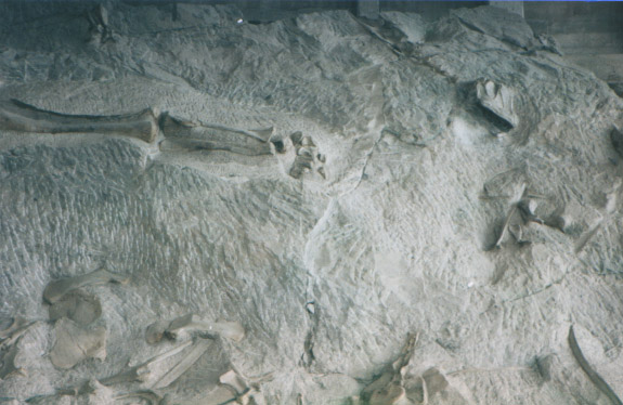
The quarry also demonstrated an artist's perception of what the dinosaurs looked like in terms of colour, habitat, and relationships with other dinosaurs. I found that fascinating how scientists attribute certain colour schemes to the skin (oh, they know the dinosaur skins are more like an elphant's than like a snake's due to impressions of skin in the mud (no fossilized skin exists)): they attribute colours to match present-day animals living in a similar climate. And you will find that many variety of colours exist (there is no wrong answer). And just to think, as a kid, I was taught they were grey and brown and pretty dull. Some present day scientists have thought up some rather elaborate colour schemes!
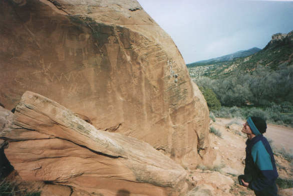
The quarry is also the home of some wonderful petroglyphs (rock drawings) from those Fremont peoples (700-1000A.D. they lived in souther Utah).
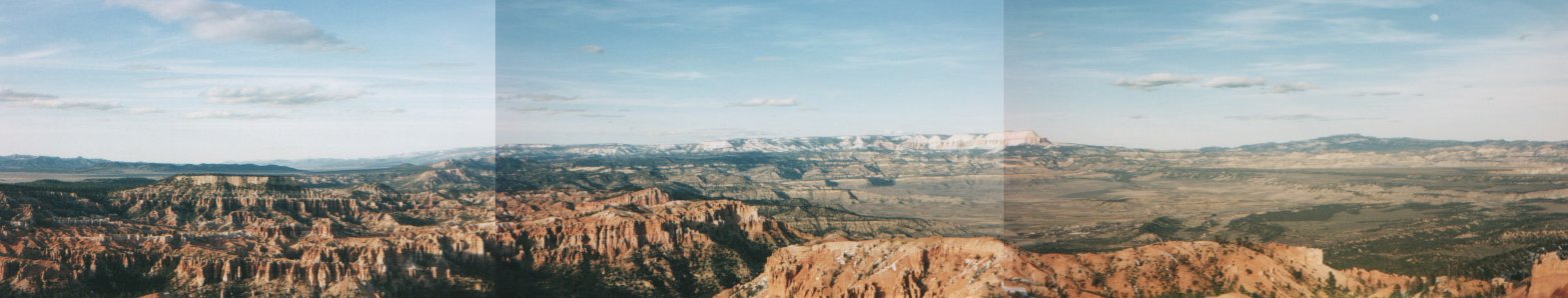
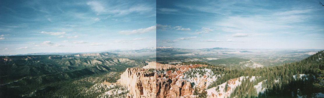
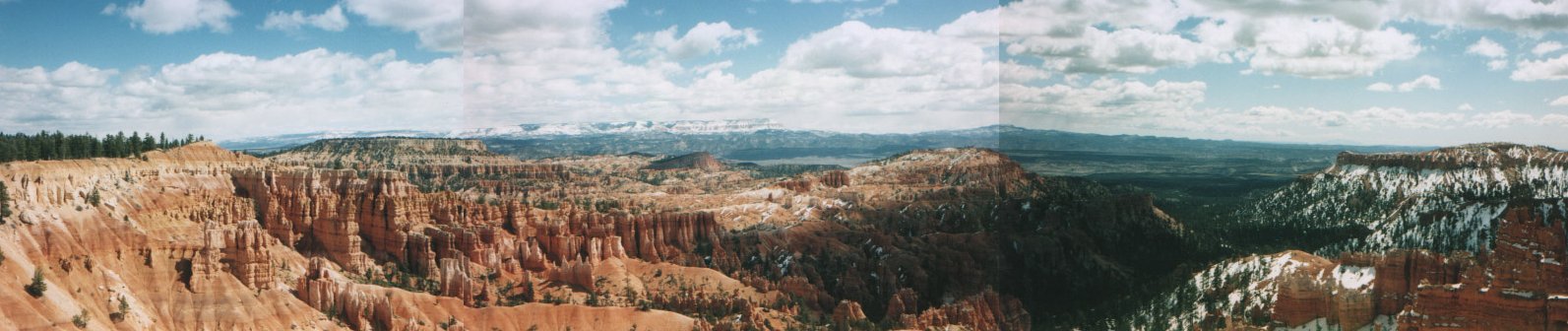
We drove south again towards Bryce Canyon. What a magical place! The ancient Indians called it "the valley of many painted faces" or something to that extent. Just imagine walking down into a canyon whose walls have been eroded away, leaving pillars of different shapes, sizes and colours. They are called "hoodoos" which means goblins. Indeed they are and it was a lot of fun to guess what we saw in those statues. In fact, part of the canyon is called Queen's Garden, after a hoodoo nearby which has the likes of Queen Victoria. Hmmm, if you asked me, I would remarked it looked like HM Queen Elizabeth. :) Then again, they are related so why not! :)
We walked the Peek-a-boo Trail and Fairyland Loop and got incredible views of this ever constantly being eroded landscape. Scientists use the length of exposed roots on the trees lining the canyon walls to determine how much sandstone is being eroded away. In most places in Bryce, this is 6 inches a year.
Doug and I sure enjoyed our hikes in Bryce, each one full of several wonderful views.
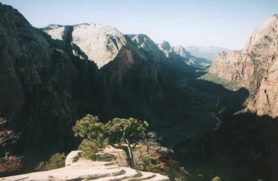
We headed to explore Angel's Landing, a hike which would involve a strenous climb up a narrow and tall (drops of 2000 feet on both sides) rock structure. It was a great climb. They had chains to assist in some areas. When we got to the top, we had a nice view down the canyon. Don't do it if you are afraid of heights. I got a big thrill out of it! :)
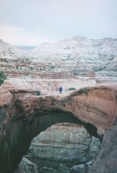
So Doug and I started the ride back home. We had to detour through northern Arizona and the Navajo Nation to get to our next destination of Hovenweep National Monument on the Utah-Colorado border. But before that, we were to pass some amazing sites. In particular, we watched the full moon rise over Monument Valley. My, that was spectacular, romantic, and oh so eerie! Doug tells me that one needs to pay for a drive tour hosted by a Navajo to see the Valley. I sure plan to do that someday, cause the isolated rocks and mounts were just awesome from a distance. Supposedly a lot of westerns have been shot there.
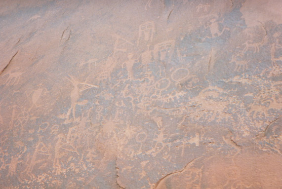
We arrive late at night outside of Bluff, Utah, and camp at Sand Island off the San Juan River. The next morning, Easter Sunday, we woke to sunrise and to a wonderful wall of petroglyphs. This wall was expansive and equalled that of Newspaper Rock (which we saw last March). A great collection of kokopelli, or flute players, were found. Being a flute player myself, I was highly delighted.
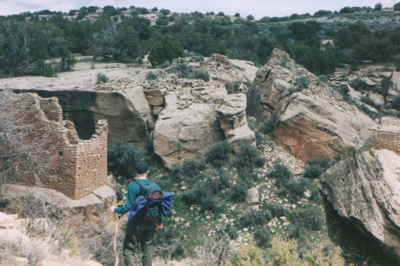
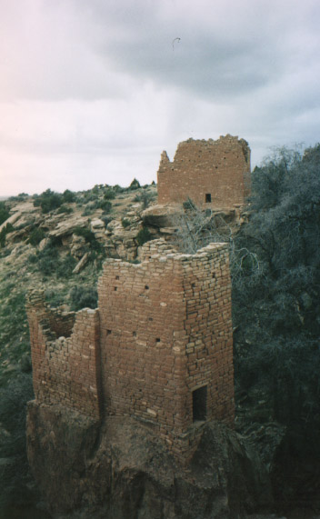
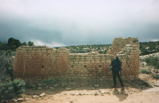
Monday we headed out to see the main Hovenweep site with towers at the mouths of canyons. Archeologists think they were used for defense, but have no idea why the Anasazi's needed such towers. Perhaps it was wars between neighbours which caused these people to mysteriously disappear in the 13th century. We drove out into the Navajo Nation to see the outlying site of Cajon Mesa. This ruined site was unique in that it was not near any canyons.
I next spent the next few days in Laramie. I had to work on a written paper for my SPIE poster. My that was rough ending my holiday with work while still on holiday. But with Ian's help we got the paper done and I had one more day with Doug. So we hit the slopes...
The slopes of the Snowies to go snowshoeing. It was a lot of fun, and exhausting. I was off the next day to return to Cambridge.
So now I am back here in Cambridge, facing the 1) fixing COHSI, 2) writing the thesis, and 3) applying for those postdocs. A lot to do in 4-5months. I am expected to submit in September. I think I mentioned that before. I still cannot envision it yet...
Spring is coming to Cambridge and the days are getting longer, which is ever so nice and encouraging to get these final months in.
Well, I do hope you enjoyed my travel tale. This will be my last summer in England so I hope to get out and do stuff. Depends of course on the writing up.
I hope my letter finds you well. Drop me a line and I am sure to get back to you!
Love
Kim