Vernadsky Base & Kimberly’s Furthest South

img_0859_1

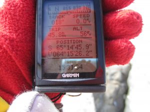
65d 14m 46.8s S, 64d 15m 27.1s W (WP146)
65d 15m 04.2s S, 64d 15m 17.2s W (WP150)

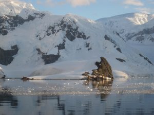
Today would mark the furthest south for me on our voyage as we visited the active Ukrainian research base Vernadsky, active since 1996 when the Ukrainians had bought the station from the British. Vernadsky is the former Faraday station for British Antarctic Science. The Brits have since opened and continue to maintain two other permanent research stations on the Peninsular, Halley at 75deg S on the Weddell Sea coast and Rothera at 67deg S on Adelaide Island.

We learned Vernadsky is the home to 11 scientists & staff, 3 of which over-winter. Areas of research focus include meteorology, upper atmosphere studies, geophysics (Vernadsky has inherited over 70 years of magnetism research log, and has maintained and upgraded the magnetic observatory and continues to add to this unique science, resulting in one of the longest and the most continuous scientific datasets from the Antarctic), biology (studying seals and fish particularly during the winter) and glaciology (measuring the local ice cap movements). No astronomy, as the weather is pretty unpredictable and clear night skies are rare.

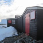
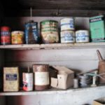
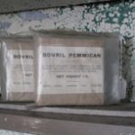
As this was a former British research station, we had the fortunate luck to be able to visit the inside of Wordie Hut (Argentine Islands), home to British researchers from 1947-1954 before Faraday was built. It has been preserved by the British Antarctic Trust and still contains canned goods, equipment and supplies just as they were left in the 1940s & 1950s.

img_0896_r


Pleneau Island

img_0832_1

65d 06m 09.1s S, 64d 02m 39.6s W (WP139)

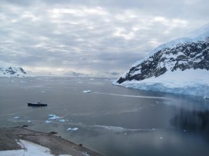
We continued south to explore the Danco Coast part of the western edge of the Antarctic Peninsula, cruising through the picturesque narrow Lemaire Channel until we go to Pleneau Island and its calm bays where a “iceberg museum of sorts” could be found. Here was a large collection of “beached” icebergs, for which the elements of wind, water, freeze & melt took control creating a variety of unique shapes.

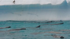
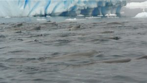
Among these amazing icebergs, we were treated to a rare sighting of over 200 crab-eater seals swimming together in formation. It was certainly a sight to see and reminded me what these waters might have been like hundreds of years ago before humans came to hunt the mighty whales. I took a lot of video to capture the fluid motion of these animals. For now, here are two snapshots.

dsc03466

dsc03460

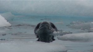
We also were courted by a leopard seal, the king of these oceans, well fed due to the local Gentoo penguin rookery nearby.
 dsc03446
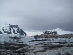
Pleneau Island itself was an interesting collection of large granite slabs, very different than any of the previous islands we had moored upon. It also spotted a nice areal coverage of pink algae that added to the many colours of the landscape.

Picnic in Paradise Bay

img_0801_1

64d 53m 24.5s S, 62d 51m 47.6s W (WP134)

Today was a day of magnificent scenery. Predawn had superb lighting (along Gerlache Strait) and each way you look ed you saw new shapes. The day remained moderately cold (at +5deg C) all day. It was a day of “white cold magnificence.”

We ended the day’s festivities with a picnic out on the stern deck of the Polar Pioneer, including ice cream. It was stunning as the sun set, casting its colours along Argentine base Brown. Three hundred and sixty degrees of beauty.

Brash Ice at Neko Harbor

img_0785_1

64d 50m 38.1s S, 62s 31m 51.5s W (WP130)

With each excursion into the land of ice and snow, my “ice vocabulary” expanded. We had experienced some sea ice (salt-water ice) and pack ice on the skirts of the Weddell Sea two days ago, and today we got to see “pancake ice” when the sea-ice is just about to freeze, and “brash-ice” which is ice-packs created by the breakup of glaciers (fresh-water) and then recombining in the sea. I was reminded of that story about how the Eskimos have so many words for snow, and now I could understand that. The land of ice is very varied indeed.

We arrived in sheltered Neko Harbour off the Andvord Bay. Another Gentoo rookery met us on the beaches, and we climbed up to the ridge to take in 360 degrees of amazing scenery of glaciers and mountains emerging from the sea, a sea dotted with ice bergs.

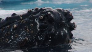
After exploring the ground, we did some cruising among the icebergs and enjoyed minutes watching two 40-foot humpback whales spy-hopping (when they poke their nose up) and doing roll-overs. I hope my video came out, but for now below is a sea-monster picture of one of the whales. I did search to find the eye, but alas, it’s lost among all the barnacles. 🙂 It is a good sea-monster picture, tho’.

dsc03380

Unnamed humpback whale spotted in Neko Harbor

Wilhelmina Bay

dsc03253_1

64d 40m 33.7s S, 62d 01m 56.7s W (WP120)

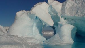
After sailing down south through the Gerlache Strait at sunrise (with amazing lighting), we moored at Wilhelmina Bay in the Antarctic Peninsula, famed for its icebergs and for whale watching. We saw plenty of the former, and very little of the latter. The collection of icebergs was impressive, varying in shape, size and texture (some icy, others bubble-pocketed, some snowy). The calm clear waters brought out the beautiful blues and whites of these magnificent shapes. Once again, one lost the size perspective, and I learned to start taking more photos of these wonderful ice-beasties with the boat or zodiac in the frame to just add a sense of scale.

We did see two Minke whales (from a distance) swimming along at a rapid pace and two Humpback whales “logging” (mainly taking a nap). And it was fun to watch the Gulls sitting atop the icebergs, as if they were kings and queens of this icy white-blue domain.