Category Archives: Travel

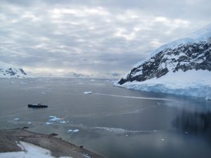
Brash Ice at Neko Harbor

img_0785_1

64d 50m 38.1s S, 62s 31m 51.5s W (WP130)

With each excursion into the land of ice and snow, my “ice vocabulary” expanded. We had experienced some sea ice (salt-water ice) and pack ice on the skirts of the Weddell Sea two days ago, and today we got to see “pancake ice” when the sea-ice is just about to freeze, and “brash-ice” which is ice-packs created by the breakup of glaciers (fresh-water) and then recombining in the sea. I was reminded of that story about how the Eskimos have so many words for snow, and now I could understand that. The land of ice is very varied indeed.

We arrived in sheltered Neko Harbour off the Andvord Bay. Another Gentoo rookery met us on the beaches, and we climbed up to the ridge to take in 360 degrees of amazing scenery of glaciers and mountains emerging from the sea, a sea dotted with ice bergs.

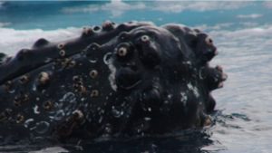
After exploring the ground, we did some cruising among the icebergs and enjoyed minutes watching two 40-foot humpback whales spy-hopping (when they poke their nose up) and doing roll-overs. I hope my video came out, but for now below is a sea-monster picture of one of the whales. I did search to find the eye, but alas, it’s lost among all the barnacles. 🙂 It is a good sea-monster picture, tho’.

dsc03380

Unnamed humpback whale spotted in Neko Harbor

Wilhelmina Bay

dsc03253_1

64d 40m 33.7s S, 62d 01m 56.7s W (WP120)

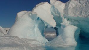
After sailing down south through the Gerlache Strait at sunrise (with amazing lighting), we moored at Wilhelmina Bay in the Antarctic Peninsula, famed for its icebergs and for whale watching. We saw plenty of the former, and very little of the latter. The collection of icebergs was impressive, varying in shape, size and texture (some icy, others bubble-pocketed, some snowy). The calm clear waters brought out the beautiful blues and whites of these magnificent shapes. Once again, one lost the size perspective, and I learned to start taking more photos of these wonderful ice-beasties with the boat or zodiac in the frame to just add a sense of scale.

We did see two Minke whales (from a distance) swimming along at a rapid pace and two Humpback whales “logging” (mainly taking a nap). And it was fun to watch the Gulls sitting atop the icebergs, as if they were kings and queens of this icy white-blue domain.

Half Moon Island and Base Camara (Arg)

img_0674_1

62d 35m 43.8s S, 59d 54m 11.6s W (WP111)

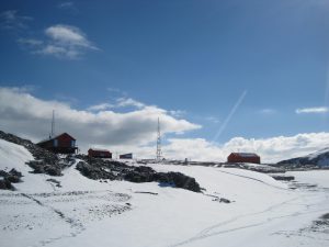
Our journey continued back through the English Strait to a cloistered island in the shape of a half moon (or rather crescent), but enough to provide a unique backdrop, but still in the South Shetland Islands. An Argentine naval base, Camara, welcomed us, and our ship, the Polar Pioneer, had astutely flown the Argentine colours when we docked. Camara has been perched there since 1953 and it really is just an outpost for the Argentine navy, and may be had some science history. This was our first introduction to the fascinating and evolving geo-political scene in the northern Antarctic area, as there are many countries who claim jurisdiction here, but actually, no country owns Antarctica per the treaty ratified by many countries back in 1959. As we would continue our journey, we would see brightly coloured huts, with large flags designating the country of origin (Spain, Argentina, Chile, etc.) reminding us of the continued human presence here.

Green-appearing Aitcho Island are full of life

dsc03156_1

62d 24m 21.8s S, 59m 44m 23.9s W (WP103)

So yes, Antarctica is indeed the land of white, the land of ice and snow, the land of awesome glaciers and towering icebergs. But we had a surprise when we visited the Aitcho Island to the NW of the Peninsula (technically back in the South Shetland Islands), teeming with life and the most flora (plants) we would see. Yes, the plants were just algae and lichens, but they carpeted these beautiful volcanic islands with style in hues of green and orange-pink.

Our short stint on this picturesque island took is through thousands of Gentoo and Chinstrap penguins. Elephant seals (the southern variety) were seen on the beach. And we encountered lots of South American Skuas (large, brown birds which are the local tyrants).

As we walked along the beaches, we stumbled upon the bones of many a great whale. Whaling was quite prominent in these parts up to the 1950s (peak in the 1910s-1930s), and these haunting bones were indeed a reminder of the past.

Gourdin Island at Sunset

img_0648_1

63d 11m 41.2s S, 57d 18m 28.6s W (WP097)

Our final stop for our first day in Antarctic waters was at Gourdin Island, just on the east side of the northernmost tip of the Antarctic Peninsula. Here there were harems of fur seals, and hundreds of Chinstrap and Gentoo with a few Adelie penguins. We went on a short hike to the ridge (384 ft) to get a great view of the Antarctic continent and the ice-infested waters. The top of Gourdin Island had a the rusted remains of a lookout or beacon post. I don’t know its dating, but it stood out among the otherwise untouched beautiful wilderness.

The icebergs in this area had ‘tide-marks’ or horizontal striping. These icebergs are ‘beached’ and the residual markings is due to the erosion by ebb & flow of wind & water of being stuck in that place in the ocean.

It was a very fine day as I took in all the new delights. I will admit I was disappointed not to see Elephant Island or the Weddell Sea. A return trip is needed, but then again, it would always be subject to the changing conditions of this amazing place. Changing conditions, I was learning, was the norm, not the exception. Antarctica was living up to its promise of being a place of extremes.